|  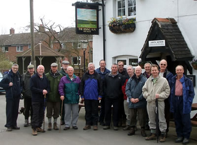
Start
Point: The Rising Sun
Church Road, Shackerstone, Nuneaton CV13 6NN Tel:
01827 880215
Photos» Description of the walk, history etc» (pdf file)
 Walk Walk
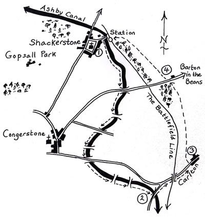
The walk is an easy 5 miles and should take no longer than
2½ hours. The walk is approximately 50% along the Ashby canal
and 50% through fields. There are a small number of stiles on the
walk through the fields and they are in the main dog friendly.
1. Pass the Rising Sun on your right and go to the end of the road. Turn right to reach the canal bridge. Take the path on your left to join the towpath. Walking south along the Ashby Canal is most pleasant -you will see narrow boats and gentle countryside in every direction. The route follows the canal for about 2½ miles. If you wish, you can make a diversion to Congerstone at bridge 49.
2. Continue on the towpath until you reach bridge 44. Turn off the towpath to the right, onto the road. Turn left over the bridge along the lane past the junction and under the railway bridge ahead on the road to Carlton.
3. Fifty yards beyond the 30mph signs, turn left over a stile at a footpath sign. Cross to the gate opposite and then make for the marker post ahead. Cross a stile and walk 20 yards right to another stile (on the Leicestershire Round). Cross this stile and then continue ahead alongside a hedge. Cross a stile and plank bridge, then walk ahead to the next marker post and stile. Bear left through a gap into a field, then right to a marker post, a stile and a plank bridge. Go ahead across an arable field to a stile, then follow a well-marked route via stiles to the edge of the wood to your left, which is on the road to Barton in the Beans.
4. Cross the road, bearing left over the next field to the corner of a wood (marker post). Then cross a stile and turn left over the next stile ahead. The railway station is in front of you. Go to the marker post at the bridge. Cross over the bridge, then turn right to follow the wide track alongside the canal. At the main road turn left back to Shackerstone.
 Directions Directions
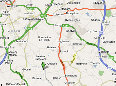
Shackerstone is to the west of Leicester and M1. For those
from the north of Leicester the village can be best approached by
coming off the M1 at junction 23, travel west on the A512 then the
A447 south to Ibstock.
Join the B586 (west) to Heather, and then follow sign (south)
to Shackerstone.
The Rising Sun is opposite to the Church.
Shackerstone
The village is the headquarters of the Battlefield Line
at Shackerstone Station which we will go through at the end of our
walk.
|